Supercell
An absolutely colossal and remarkable cloud formation giving way to dangerous and feared storm events, but also often sought by storm chasers.
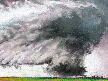
Supercell storm, oil pastel by Camille Risi from a photograph by www.extremeinstability.com, 2022.
Specific features
A gigantic whirling cloud. It resembles a giant flying saucer rotating on itself.
Origin
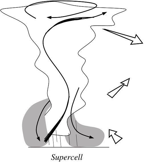 Supercells are created by winds changing directions with altitude, which gives the cloud mass a wide rotation movement. Descending air flow, generated by rain evaporation, wrap around ascending air in such a way that cold pools are displaced away from that ascending air. Cold pools are then unable to pull the rug right from under the storm cloud. Rather, wind gusts at the edges of cold pools lifts the air into updrafts, constantly alimented by warm and moist air. The supercell can then grow and last up to several hours.
Evolution
Be careful of the supercell, it can generate tremendous damages. A truly impressive phenomenon, the heart of the cloud is cooking spectacular hail, tornadoes and lightning.
When to see it
A supercell can lasts hours. It is frequent in the great plains of the United States in the summer, where the air close to the surface is hot and wet and winds change directions in altitude.