SWOT launch scheduled for December 15, 2022
The launch of SWOT, the largest oceanographic and hydrological satellite mission in the last and for the next 10 years, is scheduled for December 15, 2022 from California. From April to June 2023, more than 20 scientific missions will be conducted by the SWOT-AdAC consortium to compare satellite and in situ data.
The launch of the Franco-American SWOT satellite is scheduled for Thursday, December 15, 2022, from Vandenberg Air Force Base in California at 12:46 p.m. CET (3:46 a.m. Pacific Standard Time). This international mission will provide high-definition data on fresh and salt water over 90% of the Earth’s surface.
The SWOT (Surface Water and Ocean Topography) mission will bring together two scientific communities: oceanographers and hydrologists. It will measure the height in the Earth’s freshwater bodies and in the ocean, which will help understand how the ocean influences climate change, how global warming affects lakes, rivers and reservoirs, and how communities can better prepare for disasters, such as floods.
The first six months of the mission include a calibration and validation (CalVal) phase of the satellite, during which the satellite will fly in a one-day repeat orbit with reduced spatial coverage but improved temporal resolution. During this period, SWOT’s ascending and descending trajectories will cross each other, providing a higher temporal resolution: the crossovers.
IPSL is involved in the ocean component of SWOT, in the coordination of an international consortium of oceanographic campaigns. Indeed, the first months of the SWOT mission represent a unique opportunity to follow the rapid evolution of ocean dynamics at fine scales (1-100 km). These scales play a key role in biogeochemical cycles, marine biodiversity, and transport of energy and matter. That is why during the months of April to June 2023 more than 20 scientific missions are scheduled in different seas and oceanographic basins as wells as on coastal areas around the world. These missions are brought together in the SWOT-AdAC (Adopt a Crossover) Consortium, a forum for sharing information on how to interpret future SWOT data and for designing SWOT-compliant experimental protocols. SWOT-AdAC is endorsed by CLIVAR.
The SWOT mission is a collaboration between the CNES and NASA – with contributions from the Canadian Space Agency (CSA) and the British Space Agency. The satellite was assembled, integrated and tested at the Thales Alenia Space facility in Cannes, France.
To allow as many people as possible to follow the launch of SWOT, CNES is producing a broadcast on its Twitch et YouTube channels starting at 12:15 p.m.
More information is available on the dedicated CNES website (https://cnes.fr/fr/swot-vigie-des-eaux)
Contact : Francesco d’Ovidio
CNRS senior researcher, LOCEAN-IPSL
Email:
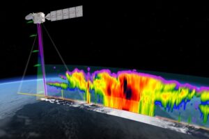
An artist’s concept of the SWOT spacecraft. The SWOT mission will measure the height of the world’s oceans, rivers and lakes, helping scientists measure changes in fresh and salt water masses over time. Credits: NASA
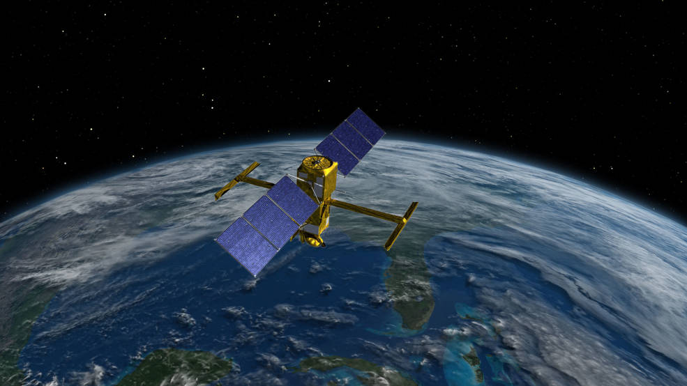
 This illustration shows the SWOT (Surface Water and Ocean Topography) satellite in orbit with its solar panels and KaRIn instrument antennas deployed. Credits: CNES
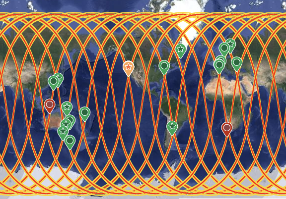
SWOT ascending and descending trajectories and the sites of the oceanographic campaigns organized within the framework of SWOT-AdAC.