In the Arctic, thawing permafrost is shaping a new geography
Researchers from the international Belmont Forum-ANR PRISMARCTYC project, of which the GEOPS and LSCE French laboratories are part, went to Yukon (Canada) for the 2nd year in a row.
The reason: studying the impacts of thawing permafrost on Arctic watersheds.
A climate vulnerable soil
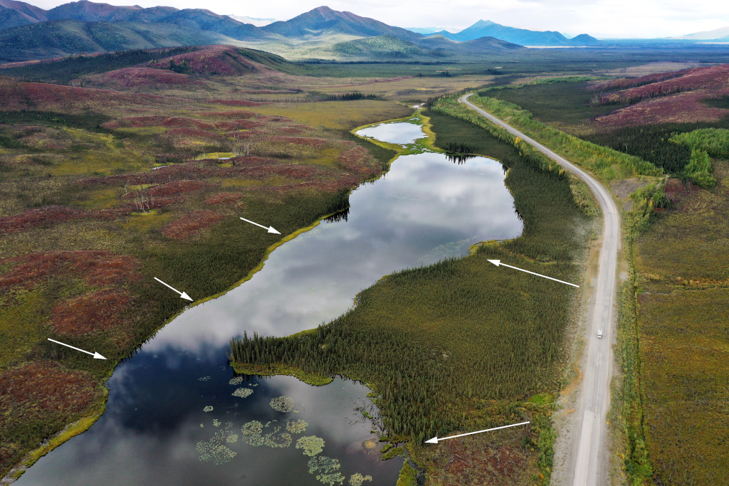
In this region in the west of Yukon (Canada), the permafrost is rapidly thawing due to global warming. The small inland Arctic watersheds are still understudied. The white arrows show how water flows to the watersheds, along the continuum. © Antoine Séjourné, GEOPS-IPSL.
Global warming is three times greater in the Arctic than elsewhere on the planet. In the Yukon region, the westernmost territory of Canada, and in parts of Siberia (Russia), the ground is frozen (permafrost) and made mostly of ice: around 70% of the volume. This makes the soil particularly vulnerable to climatic variations.
Rapid warming and the following thawing of the permafrost leads to ground sinking and many lakes appear to the surface. Organic carbon and other inorganic elements, previously trapped in the permafrost, are released into aquatic systems. Here, some microorganisms convert the newly available carbon into greenhouse gases, thereby amplifying global warming.
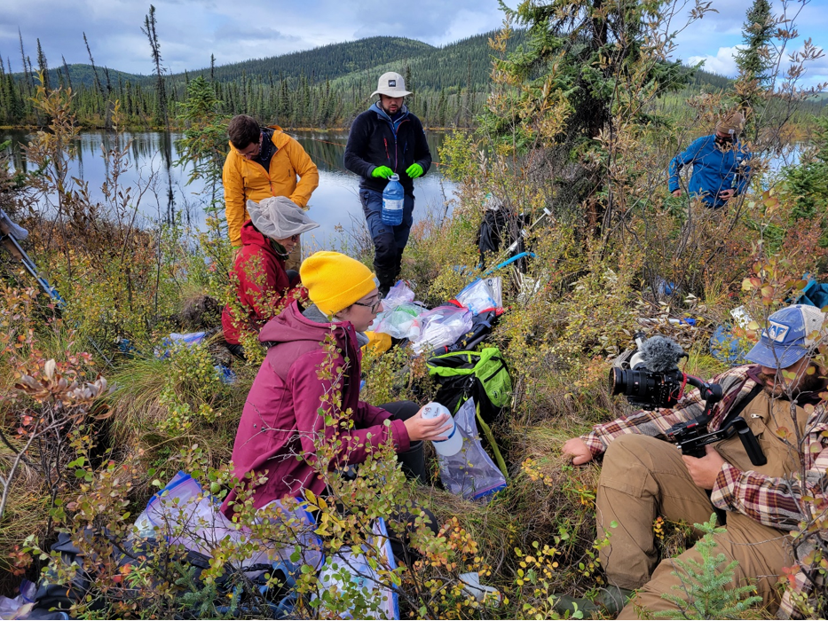
Sampling protocol of water and sediment of lake to understand the biogeochemistry and micro-organisms communities. © Antoine Séjourné, GEOPS-IPSL.
On the ground, near the border with Alaska, a team of French, Canadian, American and Japanese researchers have been studying an area where numerous lakes are actively developing as the permafrost melts. Their goal? Study the permafrost-soil-lake continuum, focusing in particular on lakes identified the previous year.
Samples and sharing
The international team collected drone images, water, gas, soil and permafrost samples and carried out geophysical surveys and drillings in the permafrost. In order to better understand the evolution of the region, the researchers also held discussions with the local community of Beaver Creek, keepers of indigenous knowledge.
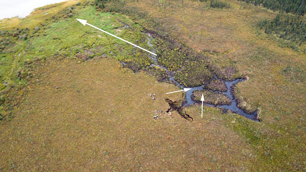
Active thawing of the permafrost along polygons on the bank of a lake. White arrows indicate the input of water to the lake along the continuum. © Antoine Séjourné, GEOPS-IPSL.
Compared with the northern tundra located further north, this part of the boreal forest is still poorly studied. The new site has been compared with areas already studied by Russian researchers, involved in the project in Siberia. A better knowledge and understanding of the changes in the carbon and hydrological cycle in the Arctic is fundamental for predicting the impact of climate change on a global scale.
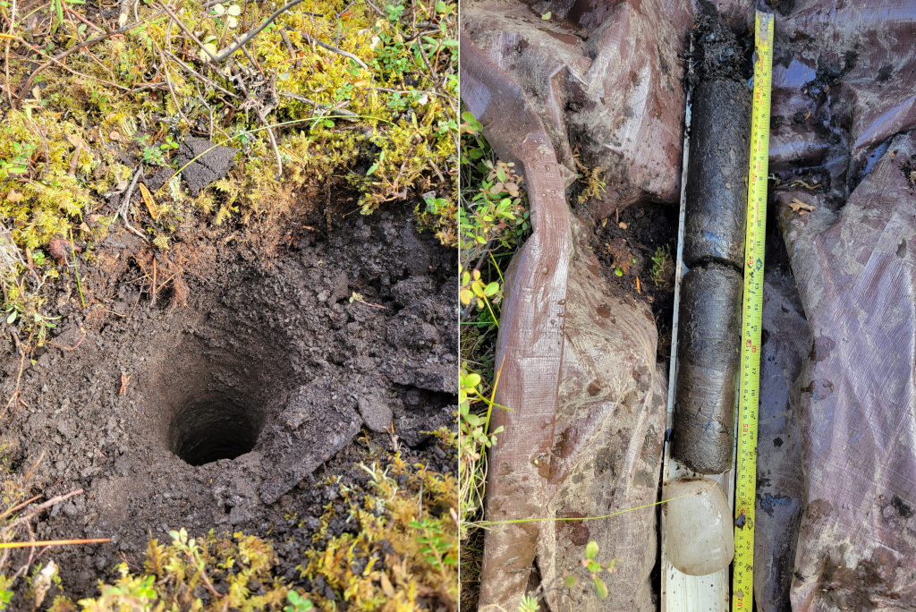
Borehole in the permafrost where ice-rich sediment and pure ice were found. © Antoine Séjourné, GEOPS-IPSL.
Contacts
- Antoine Séjourné, GEOPS-IPSL •
Find out more
Read the first episode here of Alouestes, Étape 1 : Les sols en dégel entre l’Alaska et le Canada, with Antoine Séjourné.